ESA CCI+ NO2 TROPOMI level-3 data

host: Main NO2 page at TEMIS
ESA CCI+ NO2 TROPOMI level-3 data |
|
|
Data set:
NO2
>
TROPOMI
|
OMI
host: Main NO2 page at TEMIS |
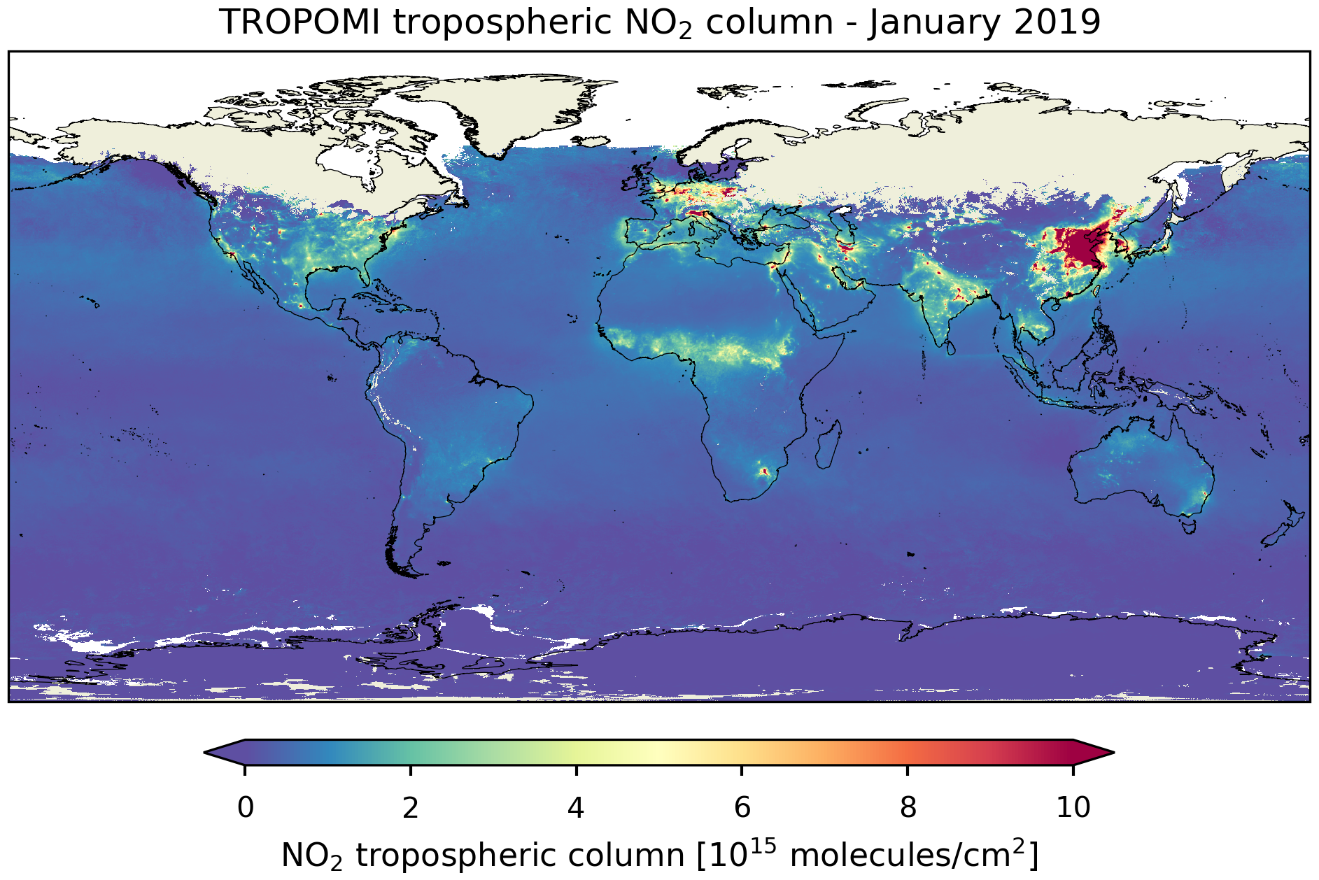
The dataset presented here is the TROPOMI daily and monthly level-3 record for nitrogen dioxide at several spatial resolutions, including a realistic uncertainty estimate. The dataset is available in netCDF files from May 2018 until November 2023. For more information and access to the data contact Isidora Anglou (isidora.anglou [at] knmi.nl).
- Publication:
- Glissenaar, I., Boersma, K. F., Anglou, I., Rijsdijk, P., Verhoelst, T., Compernolle, S., Pinardi, G., Lambert, J.-C., Van Roozendael, M., and Eskes, H.:
- TROPOMI Level 3 tropospheric NO2 dataset with advanced uncertainty analysis from the ESA CCI+ ECV precursor project,
- Earth Syst. Sci. Data 17, 4627-4650, 2025.
- doi: 10.5194/essd-17-4627-2025
- Data citation:
- Glissenaar, I. A., Anglou, I., Boersma, K. F., & Eskes, H. (2024). ESA CCI+ TROPOMI L3 monthly mean NO2 columns [Data set]. Royal Netherlands Meteorological Institute (KNMI).
doi: 10.21944/cci-no2-tropomi-l3
This dataset is part of the ESA CCI+ Precursors for aerosols and ozone project, developing long-term climate data records of the GCOS Precursors for Aerosol and Ozone Essential Climate Variable. Precursors include the short-lived atmospheric trace gases: nitrogen dioxide (NO2), sulphur dioxide (SO2), carbon monoxide (CO), formaldehyde (HCHO), and ammonia (NH3). The project focuses on building consistent/harmonised long term multi-satellite mission climate data records from satellite instruments including GOME, SCIAMACHY, GOME-2, OMI, TROPOMI, IASI, and MOPITT.
The ESA CCI+ Precursors for aerosols and ozone project consortium is based on a collaboration between BIRA-IASB, KNMI, IUP-UB, DLR, LATMOS/SU, ULB, and LAERO.
Project webpage:
https://climate.esa.int/en/projects/precursors-for-aerosols-and-ozone/
Data download -- version fv2.0
The monthly L3 TROPOMI NO2 data version fv2.0 is available from May 2018 to November 2023 at a 0.2x0.2 degree resolution. This version is produced using TROPOMI L2 NO2 versions 2.4 and 2.5, previous version fv1.0 used PAL version 2.3.1 (see Data version overview). This version replaced fv1.0 (see below) on 28 October 2026.The daily L3 TROPOMI NO2 data version fv2.0 is available from 1 May 2018 to 26 November 2023 at a 0.5x0.5 degree resolution and is produced using TROPOMI L2 NO2 versions 2.4 and 2.5.
year Monthly files (size is about 190MB each) all months 2018 01 02 03 04 05 06 07 08 09 10 11 12 zip file 2019 01 02 03 04 05 06 07 08 09 10 11 12 zip file 2020 01 02 03 04 05 06 07 08 09 10 11 12 zip file 2021 01 02 03 04 05 06 07 08 09 10 11 12 zip file 2022 01 02 03 04 05 06 07 08 09 10 11 12 zip file 2023 01 02 03 04 05 06 07 08 09 10 11 12 zip file
year Daily files, zipped per month (size is about 550MB each) all days 2018 01 02 03 04 05 06 07 08 09 10 11 12 zip file 2019 01 02 03 04 05 06 07 08 09 10 11 12 zip file 2020 01 02 03 04 05 06 07 08 09 10 11 12 zip file 2021 01 02 03 04 05 06 07 08 09 10 11 12 zip file 2022 01 02 03 04 05 06 07 08 09 10 11 12 zip file 2023 01 02 03 04 05 06 07 08 09 10 11 12 zip file
Data download -- version fv1.0
For reference monthly L3 TROPOMI NO2 data version fv1.0 is available from May 2018 to December 2021 at four different spatial resolutions. The data version is 1.26, listed in the filename as 'fv1.0' (which replaced version 1.25 on 23 October 2025).
year all months 0.2° x 0.2° 0.5° x 0.5° 1.0° x 1.0° 2.0° x 2.5° 2018 zip file zip file zip file zip file 2019 zip file zip file zip file zip file 2020 zip file zip file zip file zip file 2021 zip file zip file zip file zip file
last modified: 28 October 2026